What we do is costly! Your support will help us dig more stories.
Yes, I'm Interested!Ignorance isn't always bliss | Don't stay foolish.
Keep informed | Read our news and analysis.
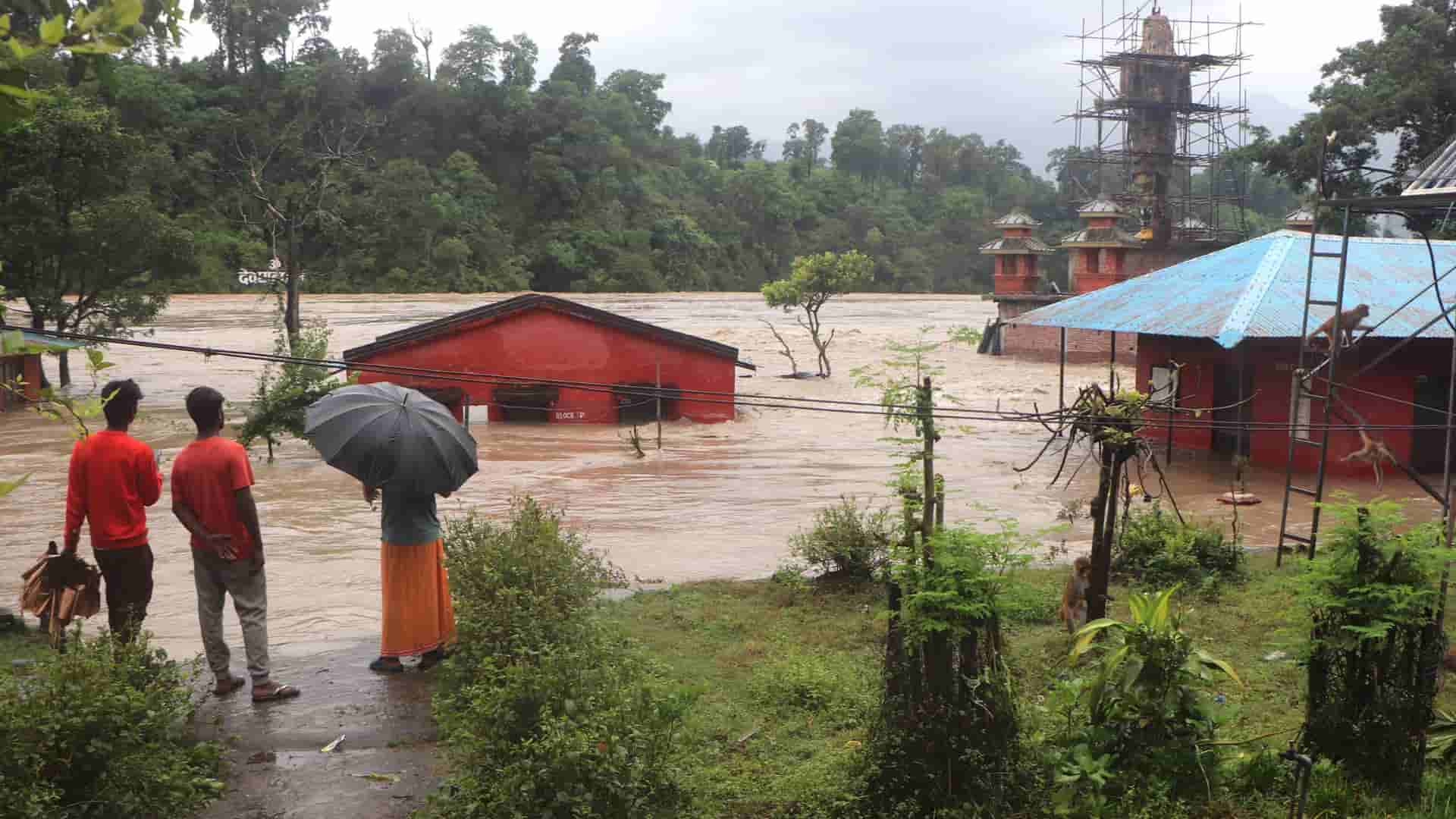
Heavy rainfall continues to trigger floods and landslides across Nepal, raising river levels, inundating settlements, and disrupting roads, bridges, and electricity infrastructure.
Narayani remains above danger level at Devghat
The Narayani River at Devghat was at 11.87 metres at 2:20 PM Sunday, well above its 9-metre danger level and 7.3-metre warning level, according to the Department of Hydrology and Meteorology. The level was classified as steady at the time of the reading.
Other rivers in the Narayani basin also remain above warning levels. The Kali Gandaki at Tatopani in Myagdi was at 5.26 metres at 5:20 AM and rising, while the Kali Gandaki at Modi Beni in Parbat was at 7.81 metres at 2:30 PM and falling. The Trishuli was at 11.71 metres at Kali Khola and 13.12 metres at Bhorle, both above their respective warning levels.
The Kiran Nala River in Banke stood at 6.43 metres at 2:30 PM, above its 6-metre warning level. The Kothi River at Lavani in Kapilbastu was at 6.49 metres, also above its warning level.
Kulekhani reservoir nears warning-siren level
The water level in the Kulekhani reservoir in Makwanpur reached 1,526.11 metres at 10:53 AM, leaving 3.89 metres before it reaches its full-storage level of 1,530 metres. The first warning siren is set to sound at 1,527 metres.
The reservoir level had been rising by around 23–25 centimetres per hour after heavy rain in the catchment. All three Kulekhani hydropower units are being operated around the clock to consume water and slow the rise. Together, the three units can generate 108 MW. Sirens have been installed in downstream areas, including Sisneri.
Narayani inundates Susta
In Nawalparasi West, the Narayani has inundated 271 houses and animal sheds in Susta Rural Municipality-5. Water has reached up to three feet inside some homes, while 172 families have been relocated to safer areas. The Armed Police Force’s border security barracks in the settlement have also been inundated.
Six houses swept away in Butwal
The Tinau River swept away six houses in Butwal-11’s Tapamajhuwa area after crossing its danger level on Saturday evening. Around 200 riverbank houses remain at risk, while security personnel evacuated about 1,000 people from vulnerable areas overnight.
Malekhu–Muglin remains disrupted, Narayanghat–Muglin road reopens
The Malekhu–Muglin section of the Prithvi Highway remains disrupted at 11 locations due to landslides triggered by continuous rain. Landslides have blocked the road at Krishna Bhir, Jyamireghat–Chaukibhir, Ghopte Bhir and Simtal, while sections near Gomti Khola at Benighat are operating one-way. The affected sections around Tingrangkhani and Jogimara–Majhimtar have also resumed one-way traffic.
Around 200 metres of road near Phishling has been covered by rocks, mud and trees, while a 30-metre section has developed cracks. Around 50 metres of road at Dharapani has partially collapsed. Authorities are clearing debris at all affected locations and expect to restore traffic by evening if no major landslides occur.
Meanwhile, the Narayanghat–Muglin road has reopened after authorities cleared a landslide and mud from the Namsi Khola bridge. The road was blocked at 7:55 AM and reopened at 12:15 PM, according to the Chitwan Road Division Office. Vehicles and freight carriers are now moving between Narayanghat and Pokhara.
Kanti Lokpath obstructed by fresh landslides
Fresh landslides have obstructed the Kanti Lokpath at Pandur and Takurche in Bagmati Rural Municipality-3 and Birkhedhara in Godawari Municipality-6, Lalitpur. The road had reopened after earlier debris clearance, but renewed rainfall triggered fresh blockages. The Makwanpur section has no reported obstruction.
Night-time travel remains restricted along the route because of continuing landslide risk.
Other highways remain affected
The BP Highway remains disrupted, while the Mid-Hill Highway, Rapti Highway and Karnali Highway have also been affected by landslides, flooding or road erosion.
In western Nepal, landslides have blocked several sections of the Karnali Corridor, including the Khachcha section towards Humla, Gaganekhola and S-Mode in Kalikot, and Aulise in Surkhet. The Mid-Hill Highway is blocked at Samlekhola in Rukum West, while the Rapti Highway is obstructed at Kharkhola in Salyan. Excavators have been deployed to clear the affected sections.
Power infrastructure affected across multiple districts
Floods, landslides and falling trees have disrupted electricity infrastructure in several districts. In Palpa, the Butwal–Palpa, Gulmi–Palpa and Syangja–Palpa 33-kV lines have been affected.
In Surkhet, a fallen tree damaged a 33-kV line serving Ramghat and Rakam and areas towards Jajarkot. The Budar–Jogbuda line in Dadeldhura has also been affected by a fallen tree.
Several hydropower projects have also been affected by flooding and landslides, disrupting electricity generation and supply.
Kaligandaki flooding expands in Parbat
The Kaligandaki has swept away 25 houses in Farse, Jaljala Rural Municipality-8, Parbat. Residents of the settlement have been moved to safety. Flooding has also inundated 50 houses in the Setibeni area across Parbat and Syangja, according to local reports.
Seti River forms temporary lake in Pokhara
The swollen Seti River has formed a large temporary lake at Ramghat, inundating parts of the riverbank, cremation sites and nearby settlements. Security personnel have been deployed, and authorities are monitoring the area, with evacuation planned if conditions worsen. The lake forms when high flows accumulate at the narrow section of the Seti at Ramghat.
Karnali rivers continue to rise
The Thuli Bheri River at Dolpa has reached 3.46 metres, just below its 3.56-metre warning level and 3.76-metre danger level, and continues to rise. The Karnali at Sarkegad in Humla is at 2.74 metres against a 4-metre warning level and is also rising.
Landslides have blocked several sections of the Karnali Corridor and Karnali Highway, disrupting road connectivity in the region.
Myagdi reports new deaths and damage
Four people have died in landslides in Myagdi, according to a newer report. Ten to 12 houses have been destroyed, while rescue operations have been hampered by road and communications disruptions. Separate reports have recorded damage to 19 houses and five animal sheds in the district, the deaths of three buffaloes and the relocation of 28 families.
More landslide deaths reported
New deaths have also been reported in Dhanusha, Palpa and Baglung. Two people died in separate landslides in Palpa, while three remain missing after a house was buried in Mathagadhi-3. In Baglung, a landslide buried a house in Nisikhola-3, killing four members of a family.
Because district reports are updated at different times and cover different areas, a single cumulative national death toll is not provided here.
DHM continues to monitor elevated river levels and rainfall across the country.
Read More Stories

Nepal needs to repeat to brand itself
Last year Nepal's goods exports jumped 81.8% to NRs 277.03 billion. That is...

Banking stocks gain momentum as dividend season begins
Dividend announcements by banks and financial institutions (BFIs) for fiscal year 2025/26 have...

Nepal’s challenge of building strong democratic institutions
Over the past few decades, institutional dysfunction and massive dissatisfaction with political establishments...