What we do is costly! Your support will help us dig more stories.
Yes, I'm Interested!Ignorance isn't always bliss | Don't stay foolish.
Keep informed | Read our news and analysis.
weather | Cyclone Arnab | heavy rainfall | snowfall | disaster risk
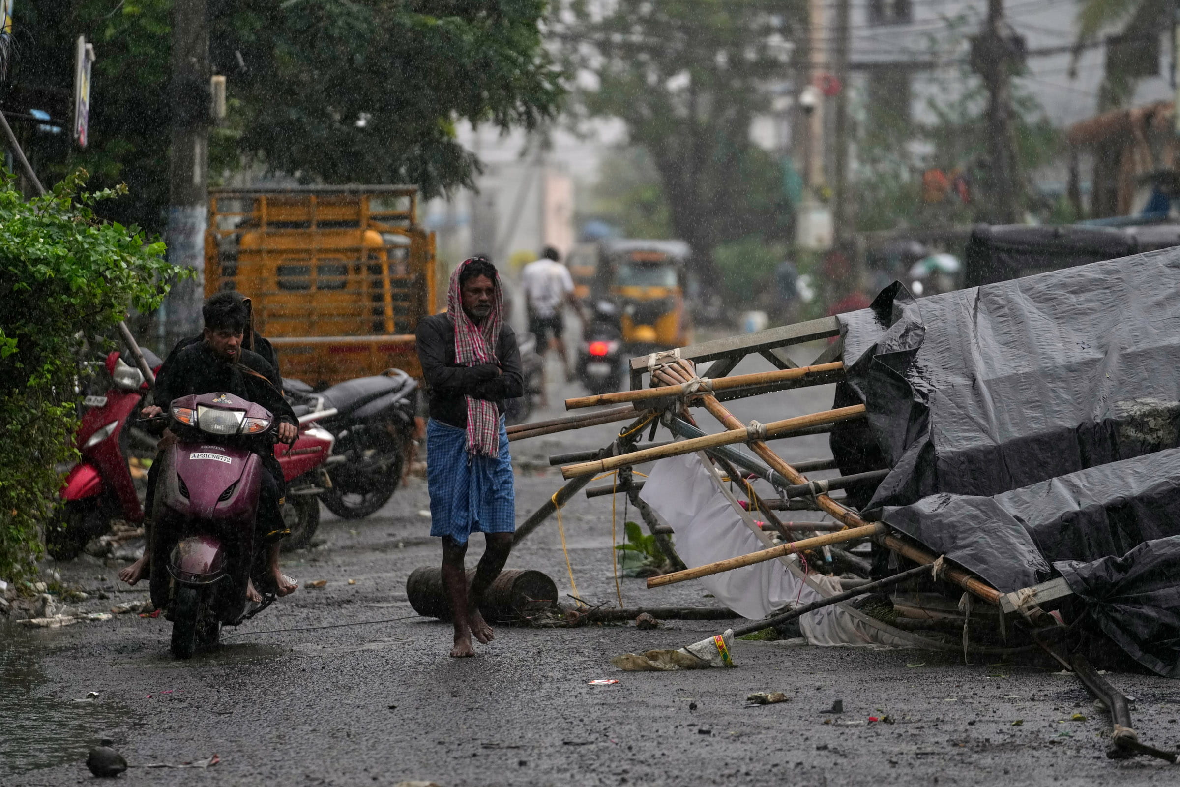
Nepal braces for adverse weather from Thursday night as Cyclone Arnab, which made landfall along India’s Andhra Pradesh coast on Wednesday, threatens heavy rainfall, thunderstorms, and snowfall across parts of the country.
The Department of Hydrology and Meteorology (DHM) has warned of increased rainfall and snowfall over the coming days, with some areas potentially experiencing heavy precipitation on Friday and Saturday. The National Disaster Risk Reduction and Management Authority (NDRRMA) has urged the public to remain alert, citing risks of flooding, landslides, heavy snowfall and avalanches.
The weather system is expected to affect Nepal through its remnants and associated atmospheric conditions rather than through a direct landfall. The extent of its impact will depend on how the system interacts with other weather patterns as it moves inland.
Heavy rain and snowfall expected across Nepal
The DHM warned that the weather system could bring moderate to heavy rainfall to several provinces, with thunderstorms and strong winds. High-hill and Himalayan areas face the risk of heavy snowfall, snowstorms and avalanches.
Koshi, Madhesh, Bagmati, Gandaki and Lumbini provinces are among the areas expected to experience rainfall, with some locations potentially receiving heavy precipitation. Parts of Karnali and Sudurpashchim provinces may also receive rain.
The forecast indicates the effects could become more pronounced on Friday and Saturday, though rainfall timing and intensity will vary by location.
Meteorologists have also reported that high clouds associated with the cyclone’s outer circulation have begun spreading over Kathmandu and other parts of Nepal. They expect isolated light rainfall on Wednesday, with the likelihood of rain increasing from Thursday evening, further warning that the interaction between moisture-laden air and an upper-level weather system could produce heavy rainfall.
Trekking permits suspended as avalanche risks rise
The Department of Immigration has suspended trekking permit issuance for restricted areas in the high hills and Himalayan regions for October 29–31.
The decision follows warnings of heavy snowfall, snowstorms and possible avalanches during the three days. Authorities have asked trekkers who have already entered affected areas to remain in safe locations and avoid trekking until conditions improve.
The Trekking Agencies’ Association of Nepal has also urged trekking agencies, guides and tourists to take precautions and review travel plans. Depending on local conditions, high-altitude journeys and mountain expeditions may need to be postponed.
Heavy snowfall can reduce visibility, make trails hazardous and increase avalanche risks. Rainfall at lower elevations may also trigger landslides and disrupt roads, trails and temporary bridges.
Travellers planning journeys through mountainous areas have been advised to follow official warnings and consult local authorities and trekking agencies before departure.
Flooding and landslides could disrupt travel
The anticipated rainfall could raise river and stream levels, increasing the risk of flash floods in vulnerable areas. Prolonged or intense rainfall may also trigger landslides, particularly in steep terrain and areas where roads and slopes have already been weakened.
Mountain communities and travellers could face additional risks from snowfall, snowstorms and poor visibility. Deteriorating weather conditions may disrupt domestic flights, road transport and outdoor activities.
The NDRRMA has urged people to avoid unnecessary travel during the adverse weather, stay away from flood-prone riverbanks and monitor official forecasts and early warnings.
The authority has also advised tourists to avoid high-altitude travel while the risk of heavy snowfall and avalanches persists.
People travelling through landslide-prone areas should check road conditions before departure and avoid crossing swollen rivers or streams. Those already in high-risk locations should follow instructions from local authorities and move to safer places if conditions become dangerous.
Farmers urged to protect crops
The forecast rainfall also poses a potential challenge for farmers during the paddy-harvesting season.
Rain falling on harvested paddy left in fields to dry could cause losses, while waterlogging and strong winds may affect standing crops in vulnerable locations.
The DHM has urged farmers to complete agricultural activities, including paddy harvesting, before the anticipated rainfall where possible.
Farmers should move harvested grain to covered storage and protect crops from rain. However, the extent of agricultural damage will depend on the actual rainfall and local conditions.
Cyclone makes landfall in India, bringing extremely heavy rain
Cyclone Arnab crossed India’s Andhra Pradesh and Yanam (Puducherry) coasts between Bapatla and Visakhapatnam between 2 AM and 8 AM IST on Wednesday, according to the India Meteorological Department (IMD).
In a press release issued at 1:45 pm IST on October 28, the IMD said the landfall process was completed by 8 AM. The storm crossed the coast as a very severe cyclonic storm, with maximum sustained winds of 125–135 kilometres per hour and gusts reaching 150 kilometres per hour.
The department recorded extremely heavy rainfall, defined as more than 21 centimetres, in coastal Andhra Pradesh and Yanam and Odisha during the 24 hours ending at 8:30 AM IST on Wednesday.
Its observations recorded 26 centimetres of rainfall at Garividi in Andhra Pradesh’s Vizianagaram district and 25 centimetres in Odisha’s Gajapati district.
The IMD forecast that the system would move north-northwestwards and gradually weaken, first into a cyclonic storm and then into a deep depression. Despite the expected weakening, it warned of continuing heavy rainfall and strong winds across parts of India.
The department also forecast further widespread rainfall in Odisha, Jharkhand and Bihar over the coming days, with isolated very heavy rainfall possible in some areas.
Separately, Indian media reported three deaths in Andhra Pradesh, 30 damaged houses and impacts across 714 villages. These figures reflect reports available at the time and should not be treated as a final official damage assessment.
The cyclone’s landfall and its continuing effects across India provide the regional context for Nepal's weather preparations. However, the IMD’s India-focused bulletin does not independently establish the severity of the forecast impacts in Nepal.
Authorities urge public to remain alert
The Nepal Electricity Authority has also warned of possible electricity supply disruptions during the expected adverse weather and urged the public to exercise caution.
Residents have been advised to follow updates from the DHM and relevant disaster management authorities rather than rely on unverified information circulating on social media.
The period from October 29 to 31 will be critical in determining the extent of the weather system’s impact on Nepal. Authorities have urged the public, travellers, farmers and tourism operators to prepare for changing conditions and take precautions based on official warnings.
While the cyclone is expected to weaken after landfall in India, the potential for heavy rain, snowfall and related hazards means vigilance will remain important across Nepal in the coming days.
Read More Stories

Dashain road crashes claim 124 lives nationwide, six killed in Monday’s SUV accident in Gulmi
Six people have died and three others have been injured after a Scorpio...

Inflation accelerates to 6.34% as food and transport costs rise
Nepals annual consumer price inflation climbed to 6.34% in mid-September 2026, up sharply...

Market edges up by a modest 0.94 points, turnover by 45%
The Nepal Stock Exchange (NEPSE) climbed up by a modest 0.94 points (0.04%)...